|
Qualified Person
Christopher Naas, P.Geo, of CME Consultants Inc., is the Qualified Person under the meaning of NI 43-101, who prepared, supervised the preparation of, or approved of the technical information being disclosed in this website. He is not independent of the Company.
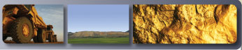
Project
The Rock Creek Ranch property is located in Humboldt County, Nevada approximately 65 km east-southeast of Winnemucca. The Property falls within the Goldrun Mining District. The land status in this part of Nevada forms a checkerboard pattern of private lands and federal lands administered by the Bureau of Land Management (BLM), part of the U.S. Department of the Interior. The current Property consists exclusively of privately held lands.
The property lies on a southwestward projection of the Getchell trend, which hosts the Pinson, Turquoise Ridge, and Twin Creeks gold mines in the Osgood Mountains. The deposits are located along the Getchell fault zone, and are hosted by the Preble, Valmy, and Comus Formations at the Pinson and Getchell mines. These mines collectively host over 15 million ounces of gold.
The Property is located in the northern portion of the Sonoma Range. This range contains Cambrian to Cenozoic rocks that vary widely in composition have experienced multiple episodes of deformation. The Paleozoic rocks that host gold deposits along the Getchell Trend are represented on the northern third of the Property. The intrusions on the Property appear to be Tertiary granites and granodiorites, as well as Tertiary felsic to andesitic dykes. These intrude Paleozoic rocks of the Valmy formation: quartzites, intermediate to mafic flows
and tuffs, and related rocks, the Preble formation: limestones, cherts, argillites, carbonaceous argillites, phyllites, quartzites and the Osgood formation: quartzites and argillites.
Exploration to date has yet to identify any gold deposits but there are several encouraging geochemical pathfinder anomalies and some anomalous gold encountered in surface samples and drilling. The Stony Basin area appears the most encouraging with broad anomalous gold zones such as 0.35 g/t over 54.00 metres and narrower zones of moderate grades such as 1.75 g/t over 4.57 metres. At the Ranch House are several promising drill hole intersection were
encountered including 1.16 g/t Au over 6.10 metres.
Deep drilling was previously recommended to be carried out in areas of the surface and near surface gold and pathfinder anomalies. Only one deep hole has been completed in the Stony Basin area. That hole encountered a thick intrusive package at depth below the Upper Platelithologies. The gold mineralization encountered on surface and the shallow drilling may represent 'leakage' from a deep, well-mineralized system. Further deep drilling would be required to test this hypothesis.
|